Kawarau Gorge Trail guide

34 km

Gibbston to Cromwell

Grades 2 to 3

800 m of climbing

Middle 13 km is remote backcountry

Opens 25 October 2026
Trail status
Why this trail matters
The Kawarau Gorge Trail is the missing link. For years, Central Otago's Great Rides and the Queenstown Trails network have sat within sight of each other, separated by one magnificent, unrideable gorge. On 25 October 2026 that changes: 34 kilometres of new trail through the Kawarau Gorge will join the Lake Dunstan Trail at Cromwell to the Queenstown Trails at Gibbston, completing around 530 kilometres of continuous riding that stretches from Queenstown all the way through the Rail Trail country toward the coast. It is the most significant trail opening in New Zealand in years, and it runs right through the middle of the country our Otago tours call home.
The trail itself has been years in the building: benched into the gorge walls, carried over the river on two new suspension bridges at the Nevis Ferry and Citroen Rapids crossings, linked by bluff bridges through country that has never had public access, past the gold-mining heritage of the Goldfields Mining Centre and beneath the Nevis Bluff.
The route
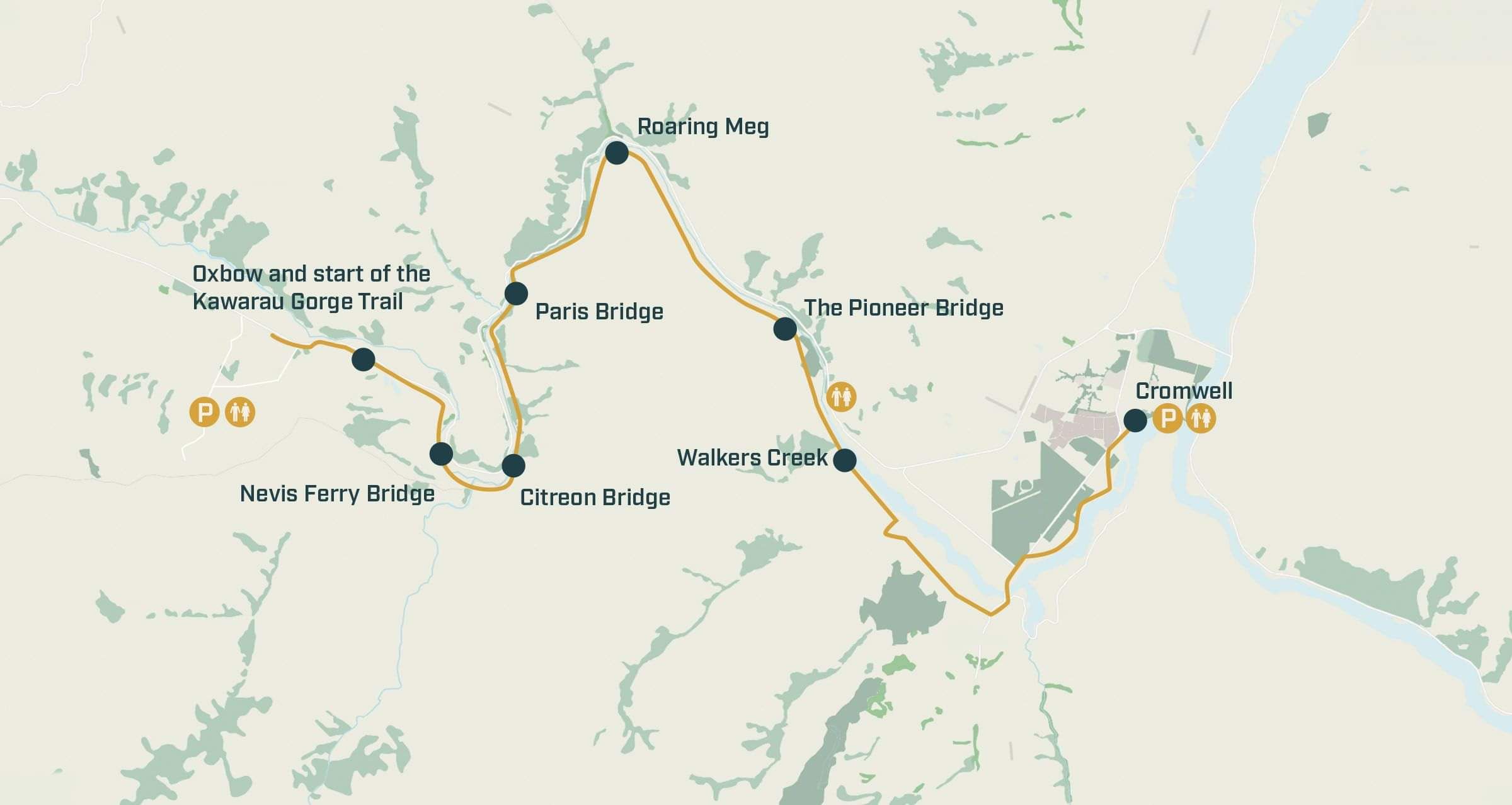
The trail runs between the Butcher Drive car park near the Cromwell Heritage Precinct, the same trailhead the Lake Dunstan Trail uses, and Oxbow Adventure Co on State Highway 6 in Gibbston. From the Cromwell end it rolls through Bannockburn's wine country before committing to the gorge proper: roughly 13 kilometres of genuinely remote riding with no exit points, the two bridged river crossings, and the sustained rolling terrain that accounts for most of the 800 metres of climbing. At the Gibbston end it delivers you into the Queenstown Trails network and the cellar-door country of the Gibbston Valley.
You will see other distances quoted around the web, from 29 to 40 kilometres. They are not wrong so much as measuring different things: hire operators quote their own depot-to-depot ride products, which bolt connecting trails onto either end. The 34 kilometre figure is the official body's, car park to car park, and it is the one this page uses.
Kawarau Gorge Trail Map
The honest bit
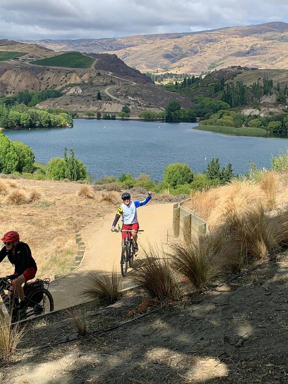
This will not be the gentle one, and the people building it say so themselves: the official guidance is that if you rode the Lake Dunstan Trail and found it challenging, the Kawarau Gorge Trail is probably not for you. Take that seriously. The numbers behind it: 800 metres of climbing over 34 kilometres, sustained rolling terrain rather than one big hill, and a middle section of roughly 13 kilometres through remote backcountry with no exit routes, so once you are in, you finish. E-bikes are permitted (pedal-assist, under 300 watts) and they are the honest recommendation for most riders, for the same reason they are on the Dunstan: they keep your attention on the trail rather than the legs. It is not a ride for young children. And two practical notes for opening season: there is strictly no parking on the state highway at the Gibbston end, and until 25 October the trail is an active construction site: riding it early damages the surface, delays the opening for everyone, and is genuinely dangerous.
Wondering where you sit? Our grades, fitness and confidence, honestly explained >
How it connects
At the Cromwell end, the trail shares its car park with the Lake Dunstan Trail, which carries on to Clyde and, through it, to the Otago Central Rail Trail, the Roxburgh Gorge and the Clutha Gold. At the Gibbston end, the Queenstown Trails network runs on toward Arrowtown and the lake. One ribbon of trail, Queenstown to the Maniototo and beyond: this is the link that makes it whole.
Ride it with the logistics handled
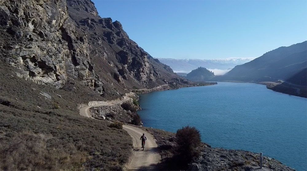
Queenstown & Central Otago Highlights, self-guided
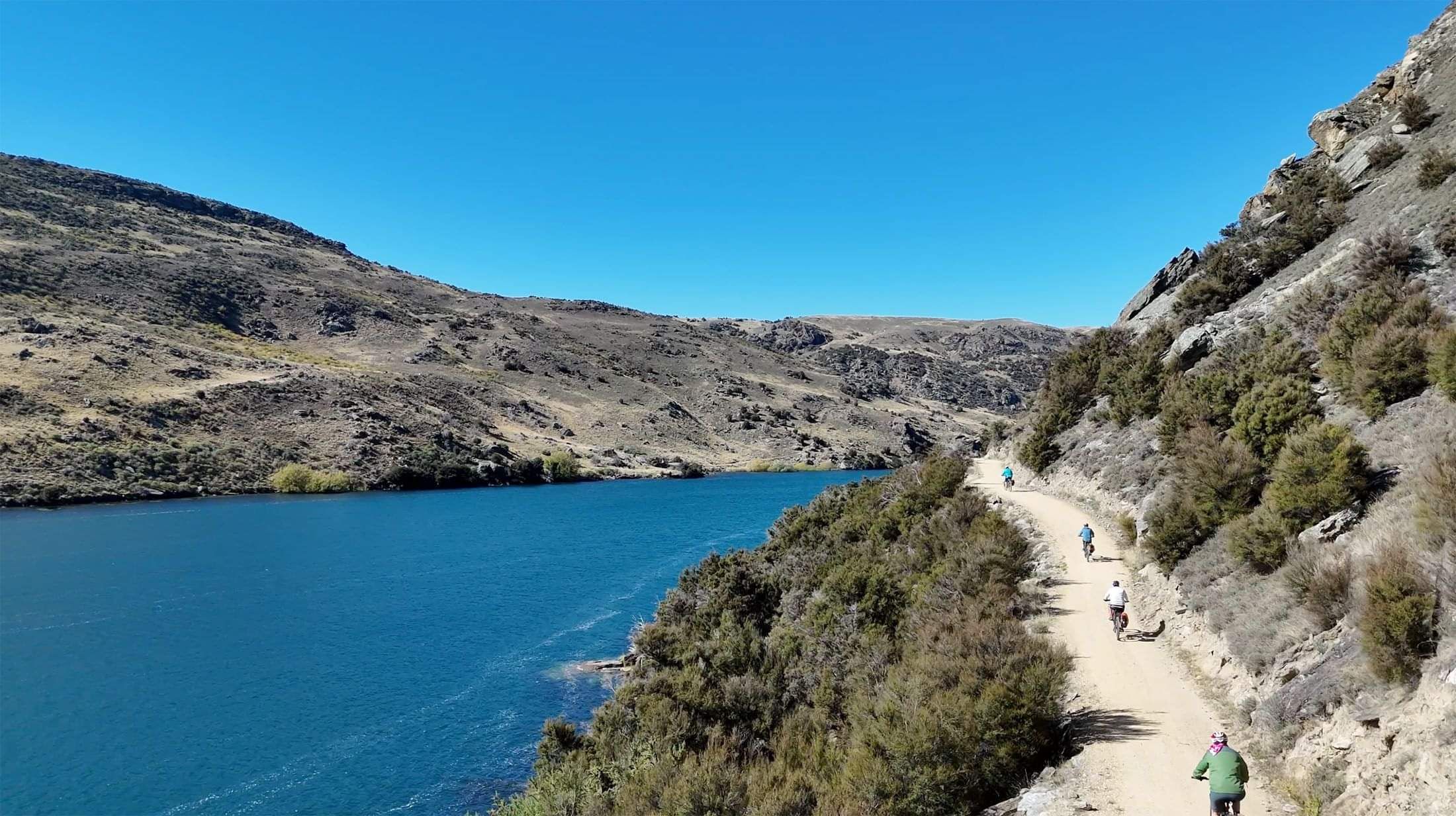
Queenstown & Central Otago Explorer, self-guided
Both tours are being finalised for the opening season. Want first word on dates and pricing? Ask us and we will reply within one business day >
When does the Kawarau Gorge Trail open?
25 October 2026. Until then the trail is an active construction site, closed to the public, and riding it early damages the surface and delays the opening for everyone.
How long is it, and how hard?
34 kilometres between Cromwell and Gibbston, with 800 metres of climbing and official grading of 2 & 3. The people building it put it plainly: if you rode the Lake Dunstan Trail and found it challenging, this one is probably not for you.
Can beginners or kids ride it?
Honestly, no. The middle 13 kilometres is remote backcountry with no exit routes, the terrain rolls relentlessly, and the trail bodies advise against young children. Gentler company in the same region: the Otago Central Rail Trail, or the Smiths Way end of the Lake Dunstan Trail.
Are e-bikes allowed?
Yes: pedal-assist e-bikes under 300 watts are permitted, and for most riders they are the honest recommendation, keeping your attention on the trail rather than the legs. No other motorised transport is allowed.
Where does it start and finish, and where do you park?
The Cromwell end starts from the Butcher Drive car park near the Heritage Precinct, shared with the Lake Dunstan Trail. The Gibbston end is at Oxbow Adventure Co on State Highway 6, where parking on the highway itself is strictly prohibited: use the designated areas.
Will there be tours and bike hire for it?
Yes: operators at both ends are gearing up for opening season, and our own two Queenstown tours ride it end to end, the four-day Highlights and the seven-day Explorer. Both are live and taking bookings now for opening season onward, any-day starts.
Pointers
Fitness, confidence and what our grades mean >
Guided or self-guided? The honest answer.>
Planning a trip on this trail and want a human answer? Ask us anything and we will reply within one business day >