Trail guides
West Coast Wilderness Trail map

133 km

Ross to Greymouth

Grade 2 trail, Grade 3 on-road sections

Most ride it in 3 to 4 days

Rideable both ways, we ride south to north

Open year round, our tours ride spring to autumn
Trail status
The trail at a glance
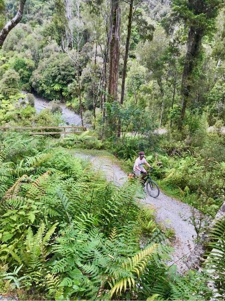
The West Coast Wilderness Trail runs between Ross and Greymouth on the South Island's wild west coast, one of the Great Rides of New Zealand and among the most rideable of all of them: gentle gradients on old water races, tramways and railway formations, through rainforest, past mirror lakes and out to the Tasman Sea. The surface is broad and well kept, the climbs are honest but brief, and the connecting on-road stretches are quiet Grade 3 riding rather than anything fierce.
It divides naturally into four sections, each roughly a day's ride, which is why most people take three or four days over it. The highest point is Kawhaka Pass at 317 metres, met at the 56 kilometre mark and reached so gradually you may need the sign to tell you.
Map
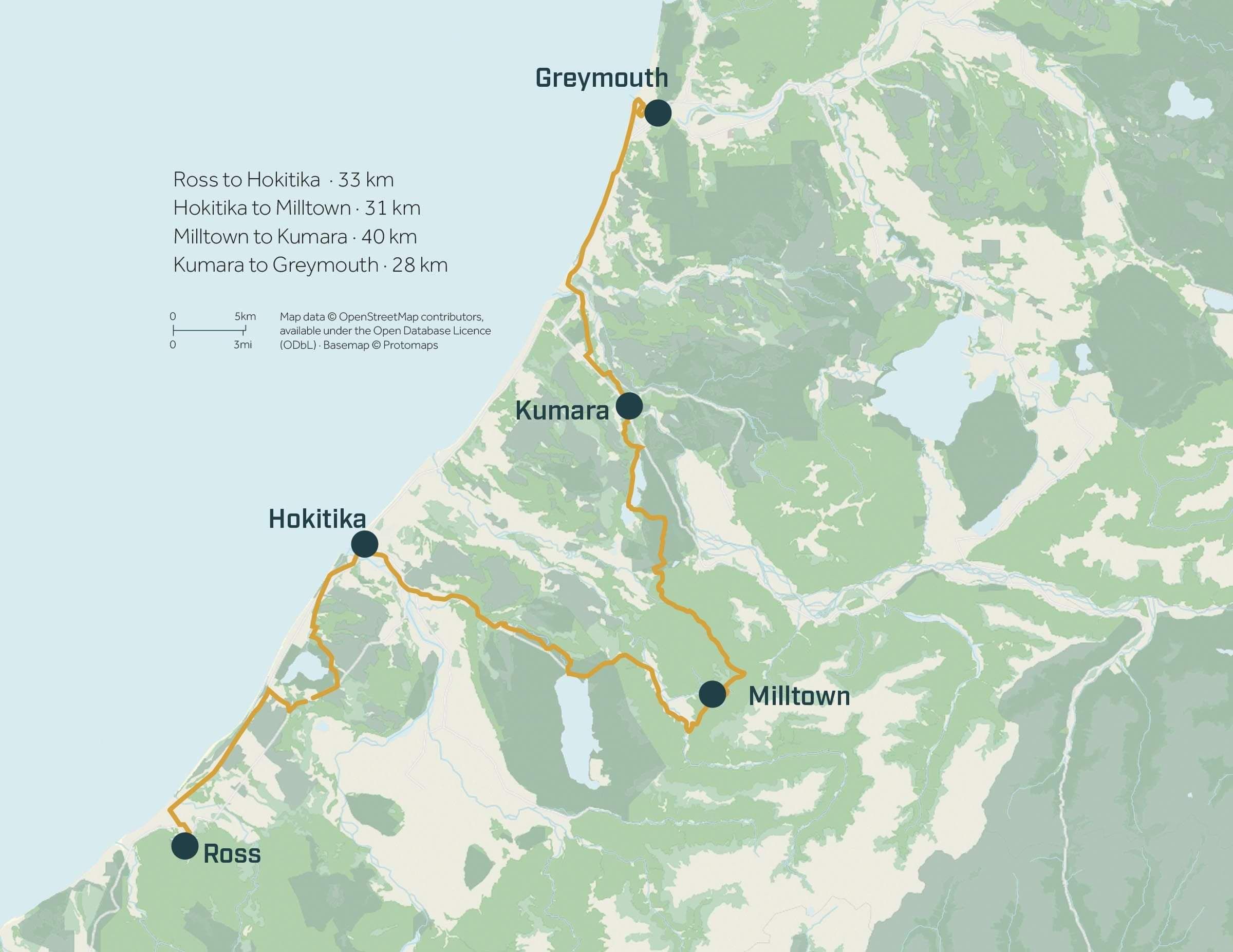
This is the full West Coast Wilderness Trail in its entirety: all four official sections, every town, the key access points. We ride it differently: our own direction, our own sequence, every bed booked and your bags travelling ahead. See how we make the best of it for you >
Section by section
Every section of the trail, in the official order. For the way we ride them, and why, see the tour >
Ross to Hokitika. 33 km · Grades 2 & 3 on road.
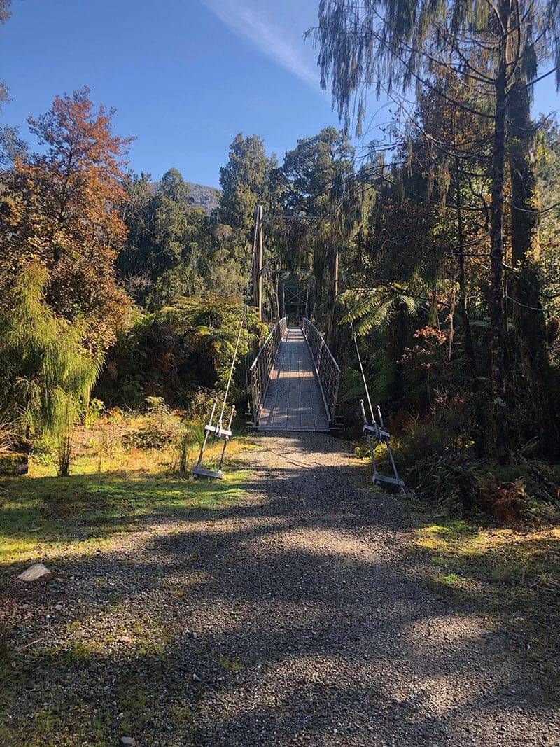
Out of the goldfields of Ross, along the old rail formation to Mahinapua Creek and the historic road-rail bridge into the Mahinapua wetlands, one of the country's finest, with the Treetop Walkway a short diversion. Then across the Hokitika Bridge and into town, with the river broadening beside you as you arrive.
Hokitika to Milltown. 31 km · Grades 2 & 3 on road · 21 km if you overnight at Lake Kaniere.
The tram road out of Hokitika, then the hand-dug 1875 Kaniere Water Race and the Kaniere Spiral, the only spiral on any trail in New Zealand, to Lake Kaniere: eight kilometres of deep water under towering kahikatea. Over Pyramid Hill to the old milling site at Milltown, the official section boundary and a shuttle pickup point. A local's note: as a place to stay, Milltown suits few, base yourself in Hokitika or Kumara instead, where the beds and dinners are.
Milltown to Kumara. 40 km · Grades 2 & 3 · crosses the trail's 317 m summit.
From Milltown past the improbable Wild West outpost of Cowboy Paradise and across the exhilarating MacPherson's Creek Bridge, climbing through podocarp forest to the Kawhaka summit, 317 metres and the roof of the ride. Then the long, lovely descent on old pack track and water races down the Kawhaka Valley, past the Loopline and Kapitea reservoirs to the gold town of Kumara. Remote, gorgeous, and the stretch where the Coast feels furthest from anywhere.
Kumara to Greymouth. 28 km · Grade 2 · gently down to the sea.
The Londonderry Rock side trip near Kumara is a short detour to a very large piece of glacier homework before the trail eases seaward: across the Taramakau on the old road-rail bridge's clip-on path, then north beside the Tasman to the breakwater where the river argues with the sea, and along the Grey River floodwall into Greymouth.
Access and logistics
Greymouth and Hokitika are the two main gateways. Greymouth is the TranzAlpine railhead, which makes a car-free trip genuinely easy from Christchurch; Hokitika sits mid-trail with the most accommodation and cafes and works beautifully as a base. Kumara and Ross bookend the quieter halves.
When to ride and e-bikes
The trail rides year round. Summer brings the long days, autumn the stillest lakes. Locals do ride it in winter, crisp and empty and beautiful. Our tours run spring through autumn, and after three decades of West Coast winters, there is wisdom in that. And in every season this is the West Coast: rain is part of the deal, it rarely lasts, and the forest is at its most glorious straight afterwards. E-bikes suit the trail perfectly: the gradients are gentle, charging is available in the towns, and the assist turns the pass into a footnote.
The honest bit
Two things the brochures underplay. The on-road connections are quiet but real roads: Grade 3 means holding your line with occasional traffic, and riders who have never shared a road should know that before booking anything. And the west coast weather writes its own itinerary sometimes: build a spare hour into each day, carry a proper rain layer even in January, and treat the forecast as a suggestion. Neither changes how good this trail is; knowing both makes the trip better.
How it connects
The trail anchors the wider coast: the TranzAlpine links it to Christchurch in an afternoon, Hokitika Gorge sits a short drive inland for a rest-day walk, and the Treetops Walkway stands just off the Mahinapua stretch. For riders assembling a bigger South Island journey, this trail opens our ten-night guided route north through Kawatiri, Tasman and Marlborough country.
Ride it with the logistics handled
West Coast Wilderness Trail, self-guided
Wilderness, Coastlines & Vines, guided
Questions about this tour
How many days do you need for the West Coast Wilderness Trail?
Three to four days for the full 133 kilometres, which is the official recommendation and a comfortable pace. The four sections also work beautifully as stand-alone day rides, and Hokitika's mid-trail position makes it an easy base if you would rather unpack once and use the shuttles.
Which direction should you ride it?
Either: the trail is officially rideable both ways and the gradients are kind in each. Starting from Greymouth suits anyone arriving car-free on the TranzAlpine, and riding north-to-south leaves the Totara Bridge closure at the far end of your trip rather than the start.
Can you still ride to Ross with the Totara Bridge closed?
Mostly, with care. The official guidance is to ride the old rail line out to the bridge and back, or, for competent riders taking real care, follow the road down to Ross: the road leg is not recommended for children. Check the official trail alerts for the current word before you ride.
How hard is it really?
One of the most rideable Great Rides there is: Grade 2 trail with Grade 3 on the quiet connecting roads, and a summit at Kawhaka Pass of just 317 metres, reached so gradually you may need the sign to tell you. The on-road stretches ask for road sense rather than fitness, and e-bikes flatten the rest.
What is the weather actually like?
It is the West Coast: rain is part of the deal, it rarely lasts, and the rainforest is at its most glorious straight afterwards. Ride with a proper rain layer in the pannier whatever the month, build a spare hour into each day, and treat the forecast as a suggestion rather than a promise.